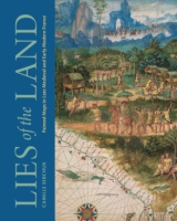


Lies of the Land
Painted Maps in Late Medieval and Early Modern France
Camille Serchuk
“This beautifully illustrated book reveals 'la voie particulière' of French cartography in the sixteenth century in admirable ways. By integrating maps created indifferent modes of production, it provides an exemplary reference framework for further studies on maps and their production across various media and diverse locations throughout Europe.”
- Description
- Reviews
- Bio
- Table of Contents
- Sample Chapters
- Subjects
Until the seventeenth century, most mapmakers in France were painters. Schooled in techniques of drawing and perspective—and in the careful study of nature that we associate with early modernity—they also learned the more expressive and imaginative Mannerist forms that dominated French painting in this period. Their maps draw on conventions of both painting and mapmaking to create beautiful, informative, and persuasive images for a wide variety of contexts and purposes. In this book, Camille Serchuk explores the strategies these cartographers deployed to weave together accuracy, ornament, and artifice in maps at all scales. Looking beyond the techniques of measurement and perspective, Serchuk shows how painterly interventions framed and manipulated the appearance and reception of cartographic objects.
Lies of the Land is an important new assessment of the character and status of early modern cartography that challenges binary distinctions between art and science and between decorative and epistemic images. It will appeal especially to art historians and historians of sixteenth-century France as well as scholars of map history.
“This beautifully illustrated book reveals 'la voie particulière' of French cartography in the sixteenth century in admirable ways. By integrating maps created indifferent modes of production, it provides an exemplary reference framework for further studies on maps and their production across various media and diverse locations throughout Europe.”
Camille Serchuk is Professor of Art History at Southern Connecticut State University. She is the cocurator, coauthor, and coeditor of the exhibition and prize-winning catalogue Quand les artistes dessinaient les cartes: Vues et figures de l’espace français, Moyen Âge et Renaissance.
List of Illustrations
Acknowledgments
Note on Translation
Introduction: Getting the Lie of the Land
1. Sight Maps / Site Maps: Painters and Local Mapping
2. The World as (Luxury) Object: Norman Maps and Atlases
3. Palace Décor(um): The Galerie des Cerfs at Fontainebleau
Conclusion: Eyeing the Horizon
Appendix: French Decorated World Maps, 1540–1635
Notes
Bibliography
Index
Also of Interest
Mailing List
Subscribe to our mailing list and be notified about new titles, journals and catalogs.